Thursday, November 23

links

I've been occupied with non-blog activities and I'm facing more of the same. In lieu of a new post of my own, I thought I'd offer some links to other sites I like.

5th Avenue in Brooklyn at 10th Street, 1909. From Forgotten NY.

Forgotten NY
is the first (and usually only) place I go to answer my questions about the history of New York's physical environment. The site is, in fact, much of my inspiration for starting the Built Environment Blog in the first place. Not only is the content brilliant, but the balance of imagery and prose is almost perfect. Also, the new Forgotten NY book by Kevin Walsh looks like the best thing ever.

Photo by Mitch Epstein from Pruned.

Pruned is probably my favorite blog. (Polis and Bird to the North are great too.) The guy that runs this site has a pretty amazing perspective on the world; he's changed my definition of what a landscape is and my understanding of how people shape it. Be careful going to this site, it's possible to get lost there for hours.

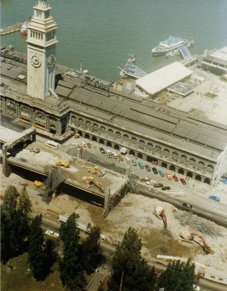
'Painted Ladies' in San Francisco from Witold Rybczynski's column on Slate.

I first encountered Rybczynski's work in my freshman year of college when I had to read City Life for an introductory Urban Studies course. It won the bronze for my favorite book of the class, losing only to The Death and Life of Great American Cities and The Social Life of Small of Urban Spaces. Several years passed before I discovered Rybczynski wrote for Slate -- now it's hard to endure the weeks between each post.

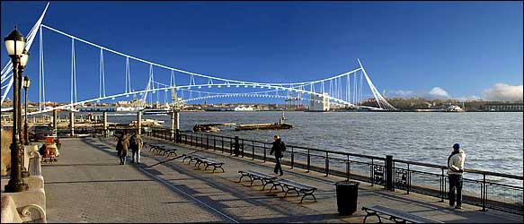
The Rolling Bridge by Thomas Heatherwick Studios.

A versatile designer who reminds me of Charles and Ray Eames, Thomas Heatherwick is at the start of what is hopefully a long and prolific career. Equally skilled in sculpture, design, and architecture, Heatherwick's work is a study in clever elegance. I first encountered his work watching a TV special that his discussed rolling bridge in London. My favorite project of his now is probably the Blue Carpet, which was built with the support of England's Commissions North (which almost made this list in its own right.)

Screen shot from Tekkon Kinkreet from PingMag.

PingMag is a Japanese design zine. I have an infatuation with Asian design and these guys seems to have their finger on the pulse of it. Even if I'm not riveted by the topic of every piece they publish, the design and writing is consistently high quality.

Wednesday, November 15

contain yourself

Container shipping is awesome. The containers themselves look like colorful building blocks, but they're hardly playthings. Without them, globalization would not exist as we know it today.

Photo by MarielleDeLosAngeles

In 1956, the first container ship set sail from Newark for Houston with 58 standard inter-modal containers. Today, 90% of the world's manufactured cargo is carried in containers -- in 2005 18 million containers were carried on the world's ships, trucks and trains.

Hong Kong2.06_58.JPGKowloon Container Port in Hong Kong, China

Unlike the infamous urban docks of the 1800's, the container ports of the 21st century are places of precision. The giraffe-like gantry cranes that ring every container port hoist containers directly onto trucks, trains, and shuttles. The entire process is conducted without goods ever leaving the containers and cargo is loaded and unloaded at an unprecedented pace.

IMG_5146bPort of Oakland from BART

Perhaps due to the specificity of their design, container ports are particularly susceptible to disasters. In 1995, the Great Hanshin earthquake hit Kobe Japan, one of the world's busiest container ports.

The earthquake turned reclaimed land around the city's waterfront to mush: retaining walls tilted towards the sea and the ground level dropped. Almost all of Kobe's 77 gantry cranes were rendered inoperable, their outer legs perched on the retaining walls and their inner legs sinking into the fill.

kobecranes1995Kobe, Japan (1995)

Container ports are also a US national security vulnerability. Their whole advantage, however, lies in operating at an efficiency that even the smoothest bureaucracy would have trouble keeping up with.

Earlier this year, Congress indirectly prevented a Dubai-based company from operating U.S. container ports. This jingoistic maneuver, which provided a false sense of security but little else, highlights the challenges of creating effective security policies for container ports.

Port Elizabeth, New Jersey

One of the best ideas in containers is just that. In 2001, Australian architect Sean Godsell came up with the Future Shack, a temporary housing unit recycled from an old cargo container. Self contained, easily transportable, and assembled in less than 24 hours, it has potential to help nations deal with disasters that displace large populations -- disasters like Hurricane Katrina or the 2004 Indian Ocean Tsunami.

Godsell has also designed a Bus Shelter House where the homeless can spend a night in comfort.

On the one hand, designing with containers seems to somehow miss the point. Containers are just part of a system -- it is the design of the system that can change the world. On the other hand, maybe container-based designs could lead to the greater globalization of ideas, not just products.

Sunday, October 29

viet nam

Earlier this year, I visited Vietnam. It was, for lots of reasons, an interesting trip to Asia.

hanoi-feet-webPhoto by Jay Brown, Lijiang Studio

In many ways, Vietnam's physical landscape typifies the parts of the planet once known as the 'third world.' Like many developing nations in the midst of industrialization, it features the startling juxtaposition of intense poverty and concentrated wealth.

Hanoi2.06_74.JPGLocated next to a modern office tower, the Cho 19-12 market sells some products not available in American stores.

At the same time, Vietnam's unique history and diverse cultural influences combine to make it a place unlike any other. The architecture of the nation reflects this singularity, and in the fabric of the built environment one can read the legacy of the various nations which have occupied it throughout its rich and varied history.

Hanoi2.06_62The Vietnamese History Museum, a French designer's interpretation of Chinese forms, epitomizes Hanoi's architecture.

In the United States, the name 'Vietnam' tends to conjure up the worst of the cold war. Especially in film, Vietnam is seen primarily as a battleground where the innocent youth of America were sent to kill the innocent youth of southeast Asia. That so many on both sides died for such unclear reasons only adds to the tragedy.

Hanoi2.06_78.JPGHoa Lo prison (aka the Hanoi Hilton.) Built by the French for political prisoners and later adapted to hold US POWs. (Including John McCain.)

In Vietnam itself, a region which has dealt with invasions for millennia, the American war is but one facet of a long era of foreign occupation. Before the United States had a political interest in the area, both France and China made Vietnam a colonial battleground, and the mark of all three powers can be found in the physical character of the nation. (With a strong Soviet influence thrown in for good measure.)

A recent article in the New York Times documenting the impact of globalization on Vietnam made me recall my time in the country, and reinforced my belief that the Vietnamese are adept at not only surviving colonial occupation, but embracing the strengths of each occupying force and using them to their advantage.

Nha Trang2.06_3.JPGNha Trang, burgeoning resort capital of Southern Vietnam. The far building under construction will be a Club Med.

One particularly interesting element of Vietnamese society is its street life. With pho (noodle) vendors on every corner and many wonderful public markets, there is much to celebrate. Still, it would be inaccurate to say that the streets were dominated by anything but the motorcycle.

In the two big cities I visited, Hanoi and Saigon (Ho Chi Minh City for my communist readers), motorcycle traffic exists at a density I would not have thought possible. Witnessing the apparent chaos at a busy intersection simultaneously reaffirmed and challenged my faith in the power of the invisible hand. I'm still not sure whether I think system 'works' or not.


I highly recommend visiting the Global South Mobility Library on YouTube. (via Bird to the North blog.)

Stop signs, traffic lights, and directional guides are rare, yet the motorcycle bound masses plow on. The phenomenon is especially interesting when considered in the context of new transportation planning theories advanced by David Engwich and Hans Monderman.

In his book Mental Speed Bumps, Engwich argues that by removing street signs, striping, and other delineations between automotive and pedestrian space, roads are actually made safer because drivers realize they are operating in places for people on foot. In practice, these theories have met with tremendous success in the Netherlands, where Dutch planner Hans Monderman has implemented them. (See Wired or the NY Times for a better explanation.)


Compare the video of Saigon to this footage from Groningen, Netherlands.


While I consider the work of Engwich and Monderman to be incredibly compelling and I think there is much to be learned from their ideas, it is critical to realize that their transportation plans are dependent upon the cultural norms of where they are applied.

Thus while it is the knee-jerk reaction of many New York planners to exclaim "'mental speed bumps' would never work in New York!", a more convincing argument, I think, is that they don't work in Vietnam.


I can watch these videos for hours, they're mesmerizing.

City plans of any sort, transportation or otherwise, must be based on a thorough understanding of the environment for which they are made. Engwich acknowledges this fact in Mental Speed Bumps. Wondering how the Dutch can share their public space so effectively, he points out the extent to the Dutch allow passersby to see into their living rooms from the sidewalk.

The Vietnamese, precisely because of their distinctive (and non-Dutch) culture, would probably have a different reaction to the removal of traffic organizing devices. This isn't to say that innovative transportation policies have no place in Vietnam -- it's just that those policies will need to be Vietnamese. (Interestingly, on my way to the airport in Hanoi, I did notice a BRT system.)

Hanoi2.06_113.JPGToto, we're not in Rotterdam anymore.

Good planners anywhere, be it Vietnam, the Netherlands or the United States, must be intimately aware of the nuances and culture of the cities they work in. While very important lessons can be learned from studying the successes of city plans around the world, it is critical that those plans be harmonized with the place of their implementation. Vietnam, with its history of absorbing bits of Chinese, French, American and Soviet culture, provides a valuable lesson.

Friday, October 20

grand army plaza

On October 17th 1989, the Loma Prieta earthquake shook San Francisco for 15 seconds, killing dozens in the Bay Area and causing an estimated $6 billion in damage. (It was the costliest disaster in US history at the time.)

One of the infrastructure elements seriously damaged by the earthquake was the Embarcadero Freeway, an elevated highway dating from the 1960s. Contentious from its very first days, the highway cut San Francisco off from its waterfront, yet was considered a critical arterial link to the Bay Bridge.


When the earthquake shut down the freeway, however, a remarkable thing was discovered: people could get around just fine without the elevated highway. In what would prove to be a defining element of the city's incredible regeneration in the years following the earthquake, San Francisco tore down the Embarcadero Freeway and replaced it with a mixed-use boulevard, relinking the downtown to the harbor.

While not despised in Brooklyn as much as the Embarcadero Freeway was in San Francisco, the intersection at Grand Army Plaza is still far from being popular. The Gordian Knot of an rotary is terrible to drive through, terrible to walk through, and terrible to bike through. If DOT Commissioner Iris Weinshall and the Bloomberg administration are as serious about changing New York's streets as they say they are, this would be an obvious place to start.


Despite its problems, Grand Army Plaza has a lot going for it. Straddling the border of Park Slope and Prospect Heights, it is the primary entrance to Prospect Park, Olmsted & Vaux's other New York City masterpiece. Every weekend when the park's drives are closed, the plaza hosts a wonderful farmer's market in its southern corner. The Soldiers' and Sailors' Arch, a towering icon honoring Union troops in the Civil War, sits near the Brooklyn Library.

Unfortunately, any chance of a pleasant experience when visiting on foot is obliterated by the absurd number of streets that intersect in Grand Army Plaza. Eastern Parkway, Union Street, Prospect Park West and Vanderbilt Avenue all terminate in Grand Army Plaza; Flatbush Avenue, the transportation aorta of Brooklyn, passes straight through.

GAP Map

Five neighborhood streets and the Prospect Park Drives also enter the intersection, meaning that while some drivers are trying to shoot through at 45 miles an hour, others are looking for parking spots.

At the same time, two rail corridors pass directly beneath the site: the 2/3 and 4/5 trains on the old IRT right-of-way, and the B/Q trains on the BMT.

IMG_3686.JPG

Thus fixing Grand Army Plaza is a bit more complicated than tearing down the Embarcadero, and there's been no singular event to force the issue. Nonetheless, I think it is crucial for the long term cultural and economic vitality of the area that the plaza not only be reorganized, but fundamentally redesigned.

A noteworthy precedent can be found in Chicago. In the 1990s, Lake Shore Drive was rerouted to allow the construction of Museum Campus, a pedestrian plaza linking the Field Museum of Natural History, Shedd Aquarium, Solider Field and Northerly Island. The project created a new waterfront district virtually overnight. (Northerly Island, formerly the site of Meigs Field, became available in 2003, when Mayor Daley had the runways at Meigs Field ripped up -- with 16 airplanes still parked on-site.)

Lake Shore Drive (foreground) used to go in between the Shedd Aquarium (left) and Field Natural History (right).

While changing the traffic pattern in Grand Army Plaza will certainly have an enormous effect on the borough's overall transportation network, it is the only way to reclaim the space for people. As the lessons of San Francisco and Chicago show, reducing the amount of automobile infrastructure and reclaiming land for pedestrians can have a dramatic and wonderful effect.

So how do you do it? Let's take another look at how things are now:

GAP looking west_2As with most photos on this blog, click the image for a link to its flickr page; you can then click 'All Sizes' for a larger view.

One of the biggest problems with Grand Army Plaza is that there's so much unused space -- remarkable, given the number of landmarks, streets, and residences in the area. A lot of the unused space is paved, such as the area between the arch and the fountain in the center of oval.

IMG_4772.JPGLet's walk to the library!

Even more space is wasted on the raised berms that ring the interior oval. Originally designed to protect the residential buildings from bothersome traffic noise, these huge piles of dirt aren't even open for dog-walking. Given what I'm paying per square foot for my apartment nearby, this is absurd. Wouldn't it be a better solution to just get rid of some of the traffic rather than block the noise?

IMG_4772.JPGTraffic! Photo by MarielleDeLosAngeles

Another problem is that high-speed traffic passing through the plaza is forced to mix with low-speed local traffic, creating confusion and disorder in a space that should be comfortable for pedestrians. Any potential change to the plaza must therefore:
  1. Adjust auto routes to separate local traffic from through traffic and reduce wasted surface area
  2. Aggregate areas not needed for auto traffic to make comfortable pedestrian space
  3. Use that pedestrian space to link the neighborhoods and landmarks that ring the plaza
As it turns out, I thought of something that might work...

NEW GAP looking west_2bAnother homemade transportation plan. The subway routes are approximate.

The key to this plan is the construction of a shallow tunnel to the east of the subway lines that would link Eastern Parkway to Flatbush Avenue. Flatbush Avenue itself will still pass through the plaza, but with both directions of traffic on the same strip of pavement. The perimeter roadway will also still circle the plaza, but it will connect to Flatbush and Vanderbilt at just the northern corner of the plaza, ensuring that it is used for local traffic only.

This plan accomplishes all three goals: the arterial roads are kept apart from neighborhood roads by moving some traffic into a tunnel and the rest onto a single above-ground roadway. The pedestrian space is combined into two sections (as opposed to the five there are now), the larger of which links the Brooklyn Library to the central plaza and the sidewalks of Prospect Heights. With the fields of Prospect Park so close, I envision this space as more of a European-style plaza than a green space; perhaps something like the recently developed Oval Basin in Cardiff, U.K.

NEW GAP looking west_2bThis used to be a basin for coal barges. It was filled in the 1960s and redesigned in 2000.

There will still be a couple messy points -- the intersection of Union Street and Prospect Park West will still be a bit tricky, for example -- but overall, I think it would be a dramatic improvement. The smaller of the two pedestrian spaces could be used to make the city's biggest dog run, a sculpture garden, or even developed with housing to finance the project. (Wouldn't the politics of that be fun?)

Flatbush Avenue would still cut the entrance of Prospect Park from the plaza, but I think a wide pedestrian bridge aligned with the opening of the arch could overcome that problem in a way that produced some incredible sight lines in both directions -- the sort of vista that Olmsted is famous for, but was never fully realized at this site.

IMG_4769.JPGThe spot in the middle of the plaza, though virtually inaccessible, is actually quite pleasant. It's also one of the most popular spots in Brooklyn for wedding photos.

The point I'm trying to make here is not that I know how Grand Army Plaza should be arranged, but that it needs to change. Despite my general wariness of new urban tunnels as a solution to urban planning problems, (see The T) in this case, I think tunnelling warrants some consideration: a relatively small tunnel could potentially make a huge difference.

In any case, Brooklyn is at a turning point in its history, and the city's leaders have an opportunity in Grand Army Plaza to make a bold statement: make yourself comfortable.

Tuesday, October 10

design/policy/chicago

Cities are shaped by many factors -- geography, economics and weather, just to name a few. Urban planners, by which I mean the broad range of professionals whose job it is to change cities, have two primary means through which to wield their influence: policy and design.

IMG_4445.JPG

I recently spent a weekend in Chicago, which is an excellent laboratory to study the different ways that policy and design can alter a metropolis. Birthplace of the skyscraper and second home of Mies van der Rohe, Chicago has always been a center of modern design. It also has a history of innovative municipal policy, and though not every experiment was a success, everything Chicago has done is influential.

Chicago Sanitation District

The creation of the Chicago Sanitation District is a good example of innovative policy. Signed into existence by the Illinois State Legislature in 1889, the Sanitation District was a legal entity designed to bypass the bureaucracy of the local government to provide the city's residents with safe drinking water. (For many years, sewage drained into Lake Michigan, which also happened to be the city's source of drinking water.)

With a board appointed by elected officials and the ability to sell bonds, the Sanitation District planned and financed a monumental engineering project that reversed the flow of the Chicago river in 1900. Later, it pioneered the use of chemical sewage treatment and built the world's largest drinking water purification plant.

Chicago Aerial 1923On the left edge of the photo, note the dark colored sewage in the Chicago River's North Fork being diverted from Lake Michigan.

The Chicago Sanitation District's basic funding mechanisms and board composition have had a huge influence on structure of later regional management organizations like the Port Authority of New York and New Jersey (1921) and BART, the Bay Area Rapid Transit District (1951).

IMG_4313.JPGOn the other hand, the Cabrini Green projects epitomize the worst of 20th century American urban renewal policies. They're finally being torn down.

For the most part, Chicago is flourishing today. While much of the recent success stems from national economic and cultural trends, Chicago's urban planning deserves at least partial credit. Implementing thoughtful design in harmony with innovative policies, Chicago's planners are achieving popular and sustainable goals: safer streets, greener buildings, and more engaging public spaces.

IMG_4644a
Due to a bit of policy I don't understand, Millenium Park is closed at 11:00pm. It did mean that I had the place to myself after sneaking in.

Chicago's newest design icon is 'the bean.' A key component of the recently completed Millennium Park, Anish Kapoor's ultra-reflective blob both engages the public and pays homage to the incredible skyline of its home. It somehow reduces inhibitions in its viewers -- adults spontaneously dance in its distorted reflections and strangers strike up conversation with one another. It is a remarkable example of almost pure design reshaping the public space.

IMG_4392.JPG

Elsewhere in the city, the influence of pure policy can be seen. On virtually every street with commercial use, cafes and restaurants have moved beyond their storefronts to take advantage of a sidewalk patio ordinance that encourages businesses to use public space. It's a simple law, but it has made an amazingly broad impact, improving the pedestrian experience in business districts across the city.

Chicago Aerial_2.jpg

In most cases, planners use a combination of policy and design to achieve civic goals -- it's not always sidewalk ordinance on the one hand and 110 tons of polished steel on the other. At its best, planning is transparent -- you have safe drinking water without thinking much about it. At its worst, planning can interfere with lives, damaging communities or forcing people from their homes. Chicago is perhaps the ideal case study for urban planners, as there is so much to learn from.

Sunday, October 1

brownstone brooklyn

Architecturally, there are a few different Brooklyns. In Williamsburg, Greenpoint, and Bushwick, industrial forms dominate the urban landscape. In some east Brooklyn neighborhoods, charming single-family homes contribute to a character that can feel a little bit more 'Long Island' than 'New York'.

Park Slope Sunset

Growing up in New England, my first impressions of Brooklyn came from the Cosby show. Perhaps that's why today, no building says 'Brooklyn' to me like the Brownstone.

Clinton Hill afternoon

Following the completion of the Brooklyn Bridge in 1883, there was a construction boom of three-to-five-story row houses to accommodate the burgeoning commuter population. Barged in from quarries in New Jersey and the Connecticut River Valley, brownstone was carried directly up Brooklyn's Gowanus Canal and then carted to nearby areas. Accordingly, the neighborhoods surrounding the canal (like Carrol Gardens, Park Slope, and Fort Greene) are of a remarkably consistent scale and style. This is Brownstone Brooklyn.

Prospect Heights morning

Ironically, some of the most interesting spots in Brownstone Brooklyn are the places where the ubiquitous row houses are absent. One of these is the Gowanus Canal itself. Odious noises and smells from industry has discouraged residential development over the years, but things could change soon. Declining urban industry, the waning of the aforementioned odor, and increasing land values suggest things will not stay the same.

Developers have been snapping up properties in the area along the canal for years now, but it's still unclear just what sort of development will take place. While it once seemed that the large scale development of the area was inevitable, lingering environmental issues and a lack of public transportation have slowed the process. Gowanus Lounge blog even doubts whether the famous (infamous?) Gowanus Whole Foods will ever get built.

IMG_4131.JPGUnion Street drawbridge

Gowanus has a number of cool old buildings and some really great bridges. The Carroll Street Bridge is one of the only remaining retractile bridges in the country and the monolithic steel viaduct at 9th Street is the highest point in the New York City subway system. It's even home to the Empty Vessel Project, a fascinating seaborne community arts experiment. Very few Brownstones, though.

Looking ahead, it's tough to imagine that Brownstone Brooklyn will remain unchanged as it heads deeper into the 21st Century. While the skyrocketing prices of brownstones in neighborhoods like Prospect Heights and South Park Slope should discourage the demolition of existing buildings (landmarking or contextual zoning laws protect buildings in some areas as well,) there are very few new rowhouses (of any material) being built. It is particularly unlikely that areas with lots of development potential -- Gowanus and the areas around Atlantic Yards, for example -- will be developed as low-rise housing given the market conditions.

IMG_0409.JPGPark Slope doors

Despite my love of brownstones, I don't think the introduction of new forms to Brooklyn is necessarily a bad thing. The brownstone emerged as a dominant style because of economic forces in the 1880s and 1890s, not because everyone thought it would be cool to build matching row houses. Working within the existing context, developers can produce structures that fit into Brooklyn's contemporary economy with a modern design vernacular. This means the area may change somewhat in appearance, but the underlying middle-class character can survive. The dangers lie at the extremes: preventing new development will cause prices to rise, turning Brownstone Brooklyn into an enclave for the wealthy; developments that ignore the existing context can interfere with the streetscape and diminish what made the area so wonderful in the first place.

Debates over development tend to be polarizing -- the best solutions usually lie somewhere in the middle. Hopefully, Brownstone Brooklyn can balance preservation with innovation as it grows into the 21st century.

Monday, September 25

best view in midtown

I've always thought that corners produced good architecture. Like Gehry's Fred and Ginger dancing in Prague or the Smurfit-Stone building's split diamond overlooking the Chicago waterfront, buildings on corners have the special ability to express themselves with two faces.

IMG_3947.JPG

The world's most famous corner building may be New York's own Flatiron building. Built in 1902, Daniel Burnham's masterpiece slices 5th Avenue from Broadway at 23rd Street, its blade-like prow standing in contrast to the open space of Madison Park. One of New York's very first steel skyscrapers -- Burnham was a Chicago-based architect and planner -- the Flatiron building is an icon of Modern American design.

As much as I love looking at the Flatiron Building from the outside, I think the view is even better from inside. Thus I especially enjoy visiting my friend who works in a publishing firm on the 17th floor.

IMG_3965.JPG

For an icon of Modern American design, the Flatiron building can be somewhat lacking in creature comforts. With a layout planned before the advent of the cubicle, offices and hallways often overlap. The elevators, despite their beautiful wrought-iron detailing, are among the slowest I've ever been on. Parts of the interior feel more like a Victorian house in Chicago than a midtown high-rise in Manhattan -- the structure is essentially an office tower designed before the modern office was invented.

IMG_3970.JPG

One quickly forgets about the quirky layout approaching a window, however, for the views from the Flatiron are incredible.


Nudging one's nose into the curved glass at the tip of the building, 270 degrees of unobstructed views present themselves to the observer. Down Broadway, past Herald Square, lies the southern tip of Times Square; up 5th Avenue, one can just pick out the green of Central Park. On port lies the Hudson, to starboard the East River. The spires of the Empire State Building and Chrysler Building punctuate an undulating skyline. In the immediate foreground teem the crowds of Madison Park (and the line for the Shake Shack.) It is the best view in midtown.

IMG_3928.JPG

It still looks good from the ground too.

Monday, September 18

triangle below canal

This weekend I spent an evening in TriBeCa, marking the first time that I've spent more time than it takes to eat a meal in the area. Despite being bordered by the vibrant neighborhoods of SoHo and Greenwich Village, TriBeCa lacks the consistent sense of place present in most other Manhattan neighborhoods. Despite a ton of awesome restaurants and some really outstanding industrial buildings, TriBeCa always feels empty to me.

IMG_3818.JPG

In his book The Image of the City (1960), Kevin Lynch produces maps by interviewing residents of Boston and asking them to sketch the city's layout. He divides the urban structures people describe into 5 categories: Paths, Edges, Districts, Nodes, and Landmarks. The distinctions between categories can be fuzzy sometimes -- the Brooklyn Bridge, for example, has the characteristics of both a path and a landmark -- but overall these 5 categories are a very effective way of describing urban space.

bostonMap of Boston by Kevin Lynch derived from interviews with Bostonians.

TriBeCa is defined by its edges. Even the name -- Triangle Below Canal -- comes from its northern boundary, not a landmark like Flatiron or a geographic characteristic like Cobble Hill. It is this lack of a uniting feature, geographic or constructed, which causes TriBeCa to feel so decentralized and empty. While I'm reluctant to make a normative judgement and say that this is a 'bad' thing, I do think that every neighborhood deserves a heart.


As with virtually every other neighborhood in New York, TriBeCa is growing rapidly. New buildings in the area are generally high rise apartment buildings without a lot of character. I suppose it's OK to have one neighborhood in Lower Manhattan without a bustling street life, but I don't see how helping TriBeCa to develop a more cohesive feel could make the area worse.

IMG_3765.JPG

As millions of dollars are poured into the World Trade Center on the southern border of this neighborhood, planners might want to think about TriBeCa as more than just a geometric form. On the other hand, maybe the neighborhood could use a square.

Thursday, September 14

you can't get there from here

On Wednesday it was reported that the Governors Island Preservation and Education Corporation (GIPEC) had scrapped every plan submitted in response to its widely publicized master plan RFP for being too expensive. (Crain's via Polis)


Home of the one of the first Dutch Settlements in the harbor, in 1698 the island was set aside by the British for Governor Lord Cornbury and the name stuck. Controlled by the military for most of its history, Governors Island served as an important strategic base for many years. More recently, the island was home to a military jail.

The southern half of the island is reclaimed land made in the 1910s with material excavated during construction of the Lexington Avenue Subway. Despite the presence of Manhattan soil, the 172 acre island only became New York property when Bill Clinton, in one of his final acts as President, designated 22 acres of the island a National Monument, setting in motion a series of events that led to the sale of most of the island to New York State and New York City for $1 in 2003.

The GIPEC, with board members appointed by City and State, requested proposals for the development of the island, receiving in response 25 plans that ranged from the visionary to the inane. (Nickelodeon helped to put together one of the proposals. Seriously.)

Whether they miscalculated when they wrote the RFP or simply didn't get any realistic proposals, the GIPEC is back to the drawing board.


A key challenge that must be overcome to stimulate development on the island will be finding a way for a critical mass of people to reach the island easily. While there's some potential in using ferries, I don't think that the system that serves the Statue of Liberty and Ellis Island would work for Governors Island, which lacks a singular attraction.

At the same time, new bridges like the one to support Calatrava's gondolas are prohibitively expensive. To keep costs down, a transportation system to Governors Island must:
  1. Use as much existing infrastructure as possible
  2. Be incorporated into a network that improves NYC's transportation as a whole
  3. Be creative
Fortunately, I've got an idea which meets these criteria. So, without further ado, my homemade Governors Island Transportation Plan:

Gov Island BRTBackground Google/MTA mash-up map from NewYorkOnTap.com, which also tells you where to find bars. Great site -- I want it for my cell phone.

As some readers may have anticipated, this is a plan for bus rapid transit, or BRT. (See previous posts The T and take the bus for more thoughts on BRT.)

The key to this plan is adapting the ventilation tower of the Brooklyn-Battery Tunnel to provide pedestrian surface access. The ventilation tower -- the large white building which appears to stick out of the north-eastern tip of the island -- would have to be outfitted with some kind of escalator or elevator system to move people from an underground station to the surface. While this certainly wouldn't be cheap, I have trouble seeing how this could be more expensive than building a whole new bridge.

The rest of the plan is remarkably simple. It involves designating restricted lanes on the West Side Highway, Brooklyn-Battery Tunnel, and Prospect Expressway for buses to create a new mass transit line. Stations could be created at locations where the route enters or exits a tunnel (Bowling Green, Columbia St) or where the line crosses a subway route (4th Ave in Brooklyn).

Besides linking Lower Manhattan to Governors Island, this would also provide a transit link to Red Hook, allowing residents of that neighborhood with a quick way to reach subway lines in Lower Manhattan or open space in Prospect Park.


Once a transit link is established, it opens the door for any number of creative development ideas for the parts of the island not protected by National Monument designation. One idea I find particularly compelling is the New Globe's vision for a Shakespearean Theater.

It turns out that Castle Williams, one of the two forts on the island, has an open courtyard with dimensions almost identical to London's Globe theater. Buoyed by an impressive list of supporters, the New Globe Theater has developed a plan featuring a new theater designed by Norman Foster inside Castle Williams. It is this sort of creative idea that could make Governors Island into an iconic place for New Yorkers and tourists alike.

I'm sure people will be able to find lots of technical problems with my transit line, and that makes sense because I'm not a civil engineer. I don't know the details of what it would take to convert the ventilation tower to some kind of elevator hybrid, but I'm mostly trying to get people thinking so I don't have to. Given the new public spaces being developed by cities like Chicago and London, the cost of inaction regarding Governors Island is too high for New York to bear. With some new thinking and a willingness to take a chance, Governors Island could become an amazing place.