Monday, September 25

best view in midtown

I've always thought that corners produced good architecture. Like Gehry's Fred and Ginger dancing in Prague or the Smurfit-Stone building's split diamond overlooking the Chicago waterfront, buildings on corners have the special ability to express themselves with two faces.

IMG_3947.JPG

The world's most famous corner building may be New York's own Flatiron building. Built in 1902, Daniel Burnham's masterpiece slices 5th Avenue from Broadway at 23rd Street, its blade-like prow standing in contrast to the open space of Madison Park. One of New York's very first steel skyscrapers -- Burnham was a Chicago-based architect and planner -- the Flatiron building is an icon of Modern American design.

As much as I love looking at the Flatiron Building from the outside, I think the view is even better from inside. Thus I especially enjoy visiting my friend who works in a publishing firm on the 17th floor.

IMG_3965.JPG

For an icon of Modern American design, the Flatiron building can be somewhat lacking in creature comforts. With a layout planned before the advent of the cubicle, offices and hallways often overlap. The elevators, despite their beautiful wrought-iron detailing, are among the slowest I've ever been on. Parts of the interior feel more like a Victorian house in Chicago than a midtown high-rise in Manhattan -- the structure is essentially an office tower designed before the modern office was invented.

IMG_3970.JPG

One quickly forgets about the quirky layout approaching a window, however, for the views from the Flatiron are incredible.


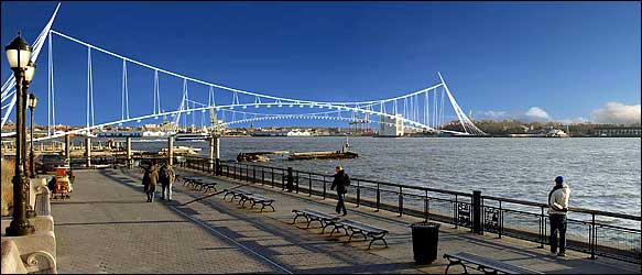
Nudging one's nose into the curved glass at the tip of the building, 270 degrees of unobstructed views present themselves to the observer. Down Broadway, past Herald Square, lies the southern tip of Times Square; up 5th Avenue, one can just pick out the green of Central Park. On port lies the Hudson, to starboard the East River. The spires of the Empire State Building and Chrysler Building punctuate an undulating skyline. In the immediate foreground teem the crowds of Madison Park (and the line for the Shake Shack.) It is the best view in midtown.

IMG_3928.JPG

It still looks good from the ground too.

Monday, September 18

triangle below canal

This weekend I spent an evening in TriBeCa, marking the first time that I've spent more time than it takes to eat a meal in the area. Despite being bordered by the vibrant neighborhoods of SoHo and Greenwich Village, TriBeCa lacks the consistent sense of place present in most other Manhattan neighborhoods. Despite a ton of awesome restaurants and some really outstanding industrial buildings, TriBeCa always feels empty to me.

IMG_3818.JPG

In his book The Image of the City (1960), Kevin Lynch produces maps by interviewing residents of Boston and asking them to sketch the city's layout. He divides the urban structures people describe into 5 categories: Paths, Edges, Districts, Nodes, and Landmarks. The distinctions between categories can be fuzzy sometimes -- the Brooklyn Bridge, for example, has the characteristics of both a path and a landmark -- but overall these 5 categories are a very effective way of describing urban space.

bostonMap of Boston by Kevin Lynch derived from interviews with Bostonians.

TriBeCa is defined by its edges. Even the name -- Triangle Below Canal -- comes from its northern boundary, not a landmark like Flatiron or a geographic characteristic like Cobble Hill. It is this lack of a uniting feature, geographic or constructed, which causes TriBeCa to feel so decentralized and empty. While I'm reluctant to make a normative judgement and say that this is a 'bad' thing, I do think that every neighborhood deserves a heart.


As with virtually every other neighborhood in New York, TriBeCa is growing rapidly. New buildings in the area are generally high rise apartment buildings without a lot of character. I suppose it's OK to have one neighborhood in Lower Manhattan without a bustling street life, but I don't see how helping TriBeCa to develop a more cohesive feel could make the area worse.

IMG_3765.JPG

As millions of dollars are poured into the World Trade Center on the southern border of this neighborhood, planners might want to think about TriBeCa as more than just a geometric form. On the other hand, maybe the neighborhood could use a square.

Thursday, September 14

you can't get there from here

On Wednesday it was reported that the Governors Island Preservation and Education Corporation (GIPEC) had scrapped every plan submitted in response to its widely publicized master plan RFP for being too expensive. (Crain's via Polis)


Home of the one of the first Dutch Settlements in the harbor, in 1698 the island was set aside by the British for Governor Lord Cornbury and the name stuck. Controlled by the military for most of its history, Governors Island served as an important strategic base for many years. More recently, the island was home to a military jail.

The southern half of the island is reclaimed land made in the 1910s with material excavated during construction of the Lexington Avenue Subway. Despite the presence of Manhattan soil, the 172 acre island only became New York property when Bill Clinton, in one of his final acts as President, designated 22 acres of the island a National Monument, setting in motion a series of events that led to the sale of most of the island to New York State and New York City for $1 in 2003.

The GIPEC, with board members appointed by City and State, requested proposals for the development of the island, receiving in response 25 plans that ranged from the visionary to the inane. (Nickelodeon helped to put together one of the proposals. Seriously.)

Whether they miscalculated when they wrote the RFP or simply didn't get any realistic proposals, the GIPEC is back to the drawing board.


A key challenge that must be overcome to stimulate development on the island will be finding a way for a critical mass of people to reach the island easily. While there's some potential in using ferries, I don't think that the system that serves the Statue of Liberty and Ellis Island would work for Governors Island, which lacks a singular attraction.

At the same time, new bridges like the one to support Calatrava's gondolas are prohibitively expensive. To keep costs down, a transportation system to Governors Island must:
  1. Use as much existing infrastructure as possible
  2. Be incorporated into a network that improves NYC's transportation as a whole
  3. Be creative
Fortunately, I've got an idea which meets these criteria. So, without further ado, my homemade Governors Island Transportation Plan:

Gov Island BRTBackground Google/MTA mash-up map from NewYorkOnTap.com, which also tells you where to find bars. Great site -- I want it for my cell phone.

As some readers may have anticipated, this is a plan for bus rapid transit, or BRT. (See previous posts The T and take the bus for more thoughts on BRT.)

The key to this plan is adapting the ventilation tower of the Brooklyn-Battery Tunnel to provide pedestrian surface access. The ventilation tower -- the large white building which appears to stick out of the north-eastern tip of the island -- would have to be outfitted with some kind of escalator or elevator system to move people from an underground station to the surface. While this certainly wouldn't be cheap, I have trouble seeing how this could be more expensive than building a whole new bridge.

The rest of the plan is remarkably simple. It involves designating restricted lanes on the West Side Highway, Brooklyn-Battery Tunnel, and Prospect Expressway for buses to create a new mass transit line. Stations could be created at locations where the route enters or exits a tunnel (Bowling Green, Columbia St) or where the line crosses a subway route (4th Ave in Brooklyn).

Besides linking Lower Manhattan to Governors Island, this would also provide a transit link to Red Hook, allowing residents of that neighborhood with a quick way to reach subway lines in Lower Manhattan or open space in Prospect Park.


Once a transit link is established, it opens the door for any number of creative development ideas for the parts of the island not protected by National Monument designation. One idea I find particularly compelling is the New Globe's vision for a Shakespearean Theater.

It turns out that Castle Williams, one of the two forts on the island, has an open courtyard with dimensions almost identical to London's Globe theater. Buoyed by an impressive list of supporters, the New Globe Theater has developed a plan featuring a new theater designed by Norman Foster inside Castle Williams. It is this sort of creative idea that could make Governors Island into an iconic place for New Yorkers and tourists alike.

I'm sure people will be able to find lots of technical problems with my transit line, and that makes sense because I'm not a civil engineer. I don't know the details of what it would take to convert the ventilation tower to some kind of elevator hybrid, but I'm mostly trying to get people thinking so I don't have to. Given the new public spaces being developed by cities like Chicago and London, the cost of inaction regarding Governors Island is too high for New York to bear. With some new thinking and a willingness to take a chance, Governors Island could become an amazing place.

Wednesday, September 13

concrete jungle

There are many theories regarding the cause of the construction boom taking place in New York and other American cities right now. Lost in the debate over social change and gentrification, however, is the simple fact that advances in concrete technology are making reinforced concrete construction cheaper than it's ever been before.


Concrete has made huge impacts on the built environment before. The biggest difference between ancient Greek and Roman construction, for example, was that the Romans used concrete to bond their masonry -- a slushy mixture of gravel, water and chemicals that cured as hard as stone. Without concrete, we wouldn't have the Pantheon or the Colosseum.

Modernity's big contribution has been the addition of rebar: steel bars embedded in the liquid as it cures that dramatically improve the material's tensile strength. Reinforced concrete has been around since the 1850s, but it wasn't used very much for residential construction until Frank Lloyd Wright's cantilevered structures, which are only possible with steel rebar, became popular in the mid-20th century.


While the construction materials used today are basically the same as those from the 1950s, there are several recent technological advances like pre-stressing which have changed how reinforced concrete is used. In New York, the most relevant of these innovations is the introduction of the concrete pumping truck.

These awesome machines are basically fire engines that pump concrete instead of water. They can either pump concrete across a long distance or up to the top of a tall structure without the use of a crane. In addition to reducing the requirements for equipment and labor, they also permit faster construction, reducing the carrying costs for a developer for a work-in-progress.


I'm cautiously optimistic about Richard Meier's new apartment building on Grand Army Plaza, which is being built with a concrete pumping truck. (The 'Putzmeister', I was delighted to learn upon closer inspection.) Though construction on this structure also used a crane, I doubt that this project would have had the budget for a starchitect like Meier without the use of pumping trucks to reduce costs.

One potential pitfall of this new technology, however, is that it can make it cheaper to build a new structure than to rehab an old one.

IMG_3248.JPGNew development along Washington DC's U Street Corridor.

One principle of Smart Growth is to reuse existing buildings as much as possible for sustainable development. With the economics of construction as they are now, it's easy to see why big developers have yet to fully sign on to this concept. Hopefully new construction technologies can reduce the cost of rehabilitating old structures as well in the near future.

In the meantime, I'll still get a kick out of watching the pumping truck that works all day behind my apartment.

Tuesday, September 12

unused FAR

One of my favorite development phenomena is the construction of a new building on top of an old one.


The primary metric used to govern building size in the New York City Zoning Resolution is Floor Area Ratio (FAR). Rather than being measured by their height or volume, buildings are measured by their FAR, which is equal to the total floor area of a building divided by the lot area. Thus a three story building that covers half its lot will have an FAR of 1.5.

Three Buildings with 1.0 FAR

One strategy developers use to make money is to look for buildings below the maximum allowable FAR in an area where there is high demand for housing. Then they buy the buildings with a low FAR, tear them down, and build a bigger building (with the maximum allowable FAR) in their place. This is a lucrative business in many neighborhoods. (And not just in NYC.)

The problem is that by tearing down the buildings, developers can change the character of the neighborhood, eliminating the feel of the place which made the area popular in the first place. New York's Department of City Planning (DCP) has made several efforts to combat this problem. The introduction of transferable air rights, for example, allows developers to transfer floor area from smaller buildings to other nearby sites. This discourages the demolition of existing buildings, but it has the side effect, for better or for worse, of creating things like the Lower East Side's new Blue development.


Rendering from Curbed.com. THOR is The Hotel On Rivington. I'll get a photo of the work-in-progress soon.

That's why it's so great when instead of tearing a building down, a developer chooses to simply add to a building's FAR by building on top. Sometimes, this addition can be very small. Imagine having a permanent tent on your roof that you lived in. I think it would be pretty sweet.

IMG_3317.JPG

Sometimes these additions can be quite well designed and attractive. The best one I've seen in New York is just south of the Puck Building, at 285 Lafayette St. (The Broadway-Lafayette stop on the BDFV trains is just to the north of the photo below.)

south of puck.jpg
The addition was made with the redder brick. This image is from http://local.live.com/, the coolest thing Microsoft has ever made.

Throughout New York, there are many areas where this kind of construction is taking place. (Take a look at Dumbo next time you're taking a train over the Manhattan Bridge.) Still, I think the city could do more to encourage this kind of development. Besides preserving the character of a streetscape, it also has relatively low capital costs, which means that many more people can become 'developers.' A few thoughtful zoning amendments could make thousands of existing buildings threatened by demolition into the foundations for new houses.

Something to think about, anyway.

Saturday, September 9

washington mews

IMG_3301.JPG

If I'm walking crosstown in the village I always pick a route that takes me down Washington Mews. It's just one block north of Washington Sqaure Park between 5th Ave and University. It feels like it's from another era. Approached from the east, this is the first taste of Greenwich Village.

The buildings were built as stables and have been converted to houses and some of the NYU language departments. If you keep walking further west, little nooks like this appear more frequently until you get to Christopher Street where all hell breaks loose in the street layout.

IMG_3303.JPG

Forgotten NY has a ton of stuff on little alleys, or any other topic related to historic New York for that matter.

mew

–noun
  1. a cage for hawks, esp. while molting.
  2. a pen in which poultry is fattened.
  3. a place of retirement or concealment.
  4. mews, (usually used with a singular verb) Chiefly British.
  • (formerly) an area of stables built around a small street.
  • a street having small apartments converted from such stables.
–verb (used with object)
  1. Archaic. to shut up in or as in a mew; confine; conceal (often fol. by up).

Thursday, September 7

The T

Decided to combine some feedback on the bus post with questions about the 2nd Ave Subway.

The map below shows the planned route of the 2nd Avenue Subway, which will be designated the "T".


The purpose of the 2nd Avenue Subway, according to the MTA's website, is to "reduce overcrowding and delays on the Lexington Avenue Line, and to improve mass transit accessibility for residents on the far East Side of Manhattan." The 2nd Avenue Subway will probably achieve these goals. The question, in my mind, is whether these goals are worthy of the $6.3-$7.8 billion the project is estimated to cost.

For that much money, why not a higher mission? Sure, life on the East Side of Manhattan has its challenges, but aren't there people in other parts of the city that could use the transit investment even more? For a project that's costing about $1,000/resident of NYC, how many people are going to get a tangible benefit from this effort? If the MTA was a private company, soley concerned with cutting a profit, then I'd say they can spend their money however they want. But the MTA is a quasi-public agency -- it has a certain responsibility to serve the people of New York. Less than a year ago, in fact, the city's taxpayers ponied up a ton of money by voting for a $450 million bond act. (An act of goodwill promptly rewarded by the transit strike.)


Urban tunnels are REALLY expensive. Boston's 3.5 mile Big Dig, like the 2nd Ave Subway, was originally estimated at a cost of about $1 billion/mile. It ended up having a whopping $14.6 billion price tag. And now chunks of the ceiling are falling off and killing people. I'm not saying that the 2nd Avenue Subway will turn out like the Big Dig, but I wonder if all that money wouldn't be better spent on something else.


In 2000, Bogota, Colombia created the Transmilenio -- a 40 mile BRT system which was carrying 1 million people/day by 2006. (You can see a photo of the main trunk line at the bottom of the previous post.) The cost? About $240 million. While it's unlikely a system in an American city could be produced as cheaply, there are certainly things to be learned from the cost-effectiveness of the Colombian example.

Stay tuned for more transportation week!

Tuesday, September 5

take the bus

For most of history, there's been one way to get around: walk. At some point, thousands of years ago, people started sailing boats, riding horses, and training pigeons to fly around with little notes tied to their legs. Until relatively recently, those developments (along with the wheel) were humankind's biggest innovations in transportation.


Thus it's difficult to wrap one's mind around the scale of the changes which have been taking place in transportation over the last 200 years ago. Since the invention of the steam engine, circa 1800, a remarkable number of new transportation modes have appeared. Let's review briefly:

1000 BC to 1800 AD (2,800 years): bigger boats, faster horses, rounder wheels
1800 AD to 2006 AD (206 years): trains, cars, helicopters, 18-wheelers, jumbo jets, space shuttles, nuclear submarines, etc


One transit mode poised for a huge comeback is the bus. While perhaps lacking the charm of a trolley or the class of a limo, buses are remarkably efficient people movers and can often get you from point A to B for cheaper than anything else.

Buses are hardly new. The first 'omnibuses' (From the Latin: 'for all people') were introduced in European and American cities in the mid-19th century. The horse-drawn carts were soon replaced by streetcars -- iron-wheeled vehicles of a similar design which were towed on rails. With the introduction of overhead wiring and electric motors, the world had its first form of mass transit: the trolley. (Cable cars are actually a different early mass-transit technology that didn't really catch on outside of San Francisco.)

The Trolley Stop has tons of information and great pictures of trolleys.

To make a long story very short, electric streetcars and passenger rail evolved into subways and elevated trains while the high costs of trolley operation (and a conspiracy...?) led to their replacement by diesel buses and private cars. (The economics of this shift were greatly influenced by the 1956 Eisenhower Interstate Highway Act.)

Buses haven't changed much since the end of the streetcar era in in the 1950s. You've still got your yellow school buses, your lurching local buses, and your regional coach buses. There are a few changes afoot in the world of buses, however, which could set the bus up for a huge comeback.


Much as it took a bare-bones airline (Southwest) to shake up the aviation business, it's taken the 'Chinatown Bus' companies operating on the Northeastern corridor to change the economics of regional transit. (Does anyone have experience with Chinatown buses in California or elsewhere? I'd be curious to hear what it's like.)

On a particularly boring Bonanza bus ride to New York several years ago, I listened in on a conversation wherein a bus driver explained how various companies -- Greyhound, Peter Pan, Trailways, etc -- had divided up regional routes amongst themselves so as to maintain pseudo-monopolies on specific corridors. I'm not sure where this chap was getting his information, but when I looked into it, there were a lot of one-bus-company towns. (So there was nothing to stop them from jacking up the price.) You can see how the Chinatown bus, which gets me to DC for $20 (about 42% less than Greyhound), is screwing up this system.

BRT: The Future of Urban Transit

The other way buses are making a breakthrough is BRT. Bus Rapid Transit is so simple it's stupid. There are two big steps.
  1. Designate lanes specifically for bus use. Ambulances and emergency vehicles can also use these lanes -- but the big deal is there's never any traffic.
  2. Set up stations where passengers can pay before boarding.
Follow these two steps and BAM! you've got a system which can transport almost as many people per hour as a subway for a fraction of the cost. Most cities already have the buses and the roads -- it's just an issue of modifying how they're used. Furthermore, buses can travel on local connector routes before joining the dedicated lanes, reducing the need for transfers and hub stations.

The ease of creating BRTs hasn't escaped the notice of municipalities with limited funds for transit, and cities across the world are developing BRT sytems right now. Some of the buses used in these systems won't resemble traditional buses very much. They'll be articulated, powered by hybrid or alternative fuel systems, and quiet.

The bus is back, baby.

Monday, September 4

transportation week!

IMG_3258a

Transportation is a funny business. In one sense, it's an industry uniquely based on service -- transportation customers pay not for a specific good, but for the movement of something from point A to point B. At the same time, transportation is all about machines. Without vehicles (and corridors to operate them on) we'd be walking everywhere. Needless to say, this is not the case. We have a great many transportation forms that we use to get around, and these varied forms have profoundly shaped our society.

I am a huge fan of subways, cars, airplanes, buses, trains, bicycles, trucks and most kinds of boats. Thus I am really looking forward to this week of blogging when I'll be discussing the impact of transportation on the built environment. In some posts I'll discuss how transportation systems affect settlement and land-use patterns; in other posts I'll ruminate on the transportation systems themselves.

kowloon container port

There are some important distinctions to keep in mind when discussing transportation. One of the most important is what is being transported. Here are three categories of things I'll use to break up the week's blogs posts:
  1. People. People move around for lots of reasons. The vehicles that move them can have a certain romance to them. The Orient Express? The Titanic? A Shelby Cobra? All people movers.
  2. Freight. Freight can be any material that isn't a person: crude oil, sunglasses, chewy nougat, whatever. I'm particularly interested in container shipping, which has made as big an impact on the globalization of industry as any other technological advance from the last 50 years.
  3. Information. For most of human history, sending information meant writing on a piece of paper and then paying someone to schlep the letter. This is no longer true. I'm going to see if I can't identify some marks in the built environment made by the internet.
IMG_3003.JPG

Friday, September 1

sticking with it

west side from hudson

I've reorganized the links somewhat. Though some of the distinctions are arbitrary, I think it's stupid to mix in all the boring research links with cool stuff like the awesome map of Chicago at Radical Cartography. In any case, I'd like this blog to be interesting and maybe even useful, so if you're curious about a topic or want to hear my opinion on something, go ahead and post a comment. I'll do my best to respond to topic requests or questions.

I'm also planning some field trips in the coming weeks (a friday night on a deserted street in hasidic williamsburg; a bike ride to the sunset park waterfront...) so let me know if you want to go for an adventure.